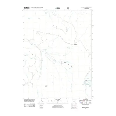
2011 Map of Dunckley Pass
USGS Topo · Published 2011About this map
Dunckley Pass serves as a critical high-altitude crossing in this portion of the Flat Tops wilderness, anchoring a landscape defined by hydraulic engineering and alpine drainage. The 2011 survey highlights an intricate network of water management features, including Sheriff Reservoir and Haley Reservoir, both supported by their respective Sheriff Dam and Haley Dam. These reservoirs, along with smaller bodies like J O K Reservoir and Gill Reservoir, suggest a history of high-country ranching and water diversion, further evidenced by the Egry Mesa Ditch skirting the edge of Egry Mesa. The area is bisected by the East Fork Williams Fork and Trout Creek, while prominent terrain features such as Baldy Mountain and Dunckley Flat define the local topography. This map is essential for tracing the physical development of water rights and access routes through this part of the Colorado Rockies.
Find a feature on this map
29 named features on this map. Tap any name to fly to it.
Don’t see what you’re looking for? This feature index may not catch every label — zoom into the map to look around manually.
Map Details
Editions of this 2011 Dunckley Pass Map
This is the sole edition of this map. No revisions or reprints were ever made.
Other maps of this area

1916 · Daton Peak
USGS Topo · 1:62,500

1920 · Daton Peak
USGS Topo · 1:62,500

1924 · Mt. Harris
USGS Topo · 1:48,000

1926 · Mount Harris
USGS Topo · 1:62,500

1954 · Craig
USGS Topo · 1:250,000

1957 · Craig
USGS Topo · 1:250,000

1958 · Craig
USGS Topo · 1:250,000

1960 · Craig
USGS Topo · 1:250,000

1962 · Craig
USGS Topo · 1:250,000

1964 · Craig
USGS Topo · 1:250,000