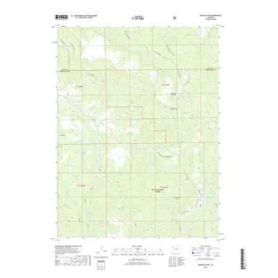
2019 Map of Dunckley Pass
USGS Topo · Published 2019About this map
Dunckley Pass and Yellowjacket Pass serve as the primary topographic focal points for this high-country survey of the Routt National Forest. The landscape is defined by its complex drainage network and water management, including the Egry Mesa Ditch and several highland reservoirs such as Gill Reservoir and the uniquely named J O K Reservoir. In the eastern portion of the quadrangle, Bunker Basin and Black Mtn Creek drop away from the higher elevations of the Dunckley Flat Tops. The area is interlaced with specialized routes including the W Fish Creek ATV trail and the W Fish Creek Foot/Horse path, illustrating the modern management of this backcountry for both motorized and traditional travel. Significant water bodies like Rainbow Lake, Wheat Lake, and Spring Lake are clustered in the southeast near Sand Cr, emphasizing the region's importance as a headwaters area.
Find a feature on this map
40 named features on this map. Tap any name to fly to it.
Don’t see what you’re looking for? This feature index may not catch every label — zoom into the map to look around manually.
Map Details
Editions of this 2019 Dunckley Pass Map
This is the sole edition of this map. No revisions or reprints were ever made.
Other maps of this area

1916 · Daton Peak
USGS Topo · 1:62,500

1920 · Daton Peak
USGS Topo · 1:62,500

1924 · Mt. Harris
USGS Topo · 1:48,000

1926 · Mount Harris
USGS Topo · 1:62,500

1954 · Craig
USGS Topo · 1:250,000

1957 · Craig
USGS Topo · 1:250,000

1958 · Craig
USGS Topo · 1:250,000

1960 · Craig
USGS Topo · 1:250,000

1962 · Craig
USGS Topo · 1:250,000

1964 · Craig
USGS Topo · 1:250,000