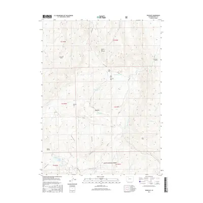
2016 Map of Dunckley
USGS Topo · Published 2016About this map
The Williams Fork Mountains dominate this high-country landscape in the Routt National Forest, where water management and ranching history are deeply etched into the terrain. The small settlement of Dunckley serves as a central point in a region defined by extensive irrigation works, including the Williams-Park Ditch and the E Side Number 2 Ditch. These systems, along with family-named water features like the James Marion Yoast Reservoir and Sellers Crowell Reservoir, illustrate the historical necessity of water diversion for high-altitude meadows like Williams Park and Dubeau Meadow. A network of thoroughfares, from the winding Routt City Rd to the W Fish Creek ATV Trail, provides access across the drainage basins of Sage Cr and Grassy Cr, highlighting a landscape that remains a vital intersection of natural resources and agricultural heritage.
Find a feature on this map
46 named features on this map. Tap any name to fly to it.
Don’t see what you’re looking for? This feature index may not catch every label — zoom into the map to look around manually.
Map Details
Editions of this 2016 Dunckley Map
This is the sole edition of this map. No revisions or reprints were ever made.
Other maps of this area

1916 · Daton Peak
USGS Topo · 1:62,500

1920 · Daton Peak
USGS Topo · 1:62,500

1924 · Mt. Harris
USGS Topo · 1:48,000

1926 · Mount Harris
USGS Topo · 1:62,500

1954 · Craig
USGS Topo · 1:250,000

1957 · Craig
USGS Topo · 1:250,000

1958 · Craig
USGS Topo · 1:250,000

1960 · Craig
USGS Topo · 1:250,000

1962 · Craig
USGS Topo · 1:250,000

1964 · Craig
USGS Topo · 1:250,000