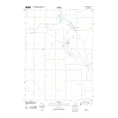
2010 Map of Dundee
USGS Topo · Published 2010About this map
The Maquoketa River and its varied tributaries, including South Fork Maquoketa River and Rieger Creek, define this portion of Delaware County. The town of Dundee serves as a central hub, featuring the Dundee Post Office and nearby Spring Hill Cemetery. To the north, the river broadens into Backbone Lake, a prominent local landmark flanked by the Forest Villa Resort and the community of Forestville.
Find a feature on this map
49 named features on this map. Tap any name to fly to it.
Don’t see what you’re looking for? This feature index may not catch every label — zoom into the map to look around manually.
Map Details
Editions of this 2010 Dundee Map
This is the sole edition of this map. No revisions or reprints were ever made.
Other maps of this area

1900 · Anamosa
USGS Topo · 1:125,000

1901 · Oelwein
USGS Topo · 1:125,000

1902 · Elkader
USGS Topo · 1:125,000

1903 · Winthrop
USGS Topo · 1:125,000

1959 · Dubuque
USGS Topo · 1:250,000

1961 · Dubuque
USGS Topo · 1:250,000

1962 · Dubuque
USGS Topo · 1:250,000

1964 · Edgewood
USGS Topo · 1:24,000

1965 · Thorpe
USGS Topo · 1:24,000

1965 · Strawberry Point
USGS Topo · 1:24,000