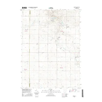
2015 Map of Dundee
USGS Topo · Published 2015About this map
The Backbone and its surrounding ridge-lines define this portion of Delaware County, where the Maquoketa River carves a narrow, winding path through the landscape. The river's course is punctuated by Backbone Lake, a prominent hydrological feature north of Dundee. This mid-2010s survey reveals a rural fabric heavily influenced by early settlement patterns and family farming, evidenced by the numerous small burial grounds scattered across the townships. Genealogists may find value in the locations of Forestville Cem, Saint Albert Cem, and the uniquely named Stanger Farm Cem. The map captures the interface between the small village of Forestville and the agricultural grid, characterized by a dense network of numbered avenues and streets that connect isolated farmsteads. High points like Wolf Hill overlook several tributaries including Sand Hagen Cr and Rieger Cr, which feed the river system as it flows toward the southeast corner of the quadrangle.
Find a feature on this map
54 named features on this map. Tap any name to fly to it.
Don’t see what you’re looking for? This feature index may not catch every label — zoom into the map to look around manually.
Map Details
Editions of this 2015 Dundee Map
This is the sole edition of this map. No revisions or reprints were ever made.
Other maps of this area

1900 · Anamosa
USGS Topo · 1:125,000

1901 · Oelwein
USGS Topo · 1:125,000

1902 · Elkader
USGS Topo · 1:125,000

1903 · Winthrop
USGS Topo · 1:125,000

1959 · Dubuque
USGS Topo · 1:250,000

1961 · Dubuque
USGS Topo · 1:250,000

1962 · Dubuque
USGS Topo · 1:250,000

1964 · Edgewood
USGS Topo · 1:24,000

1965 · Thorpe
USGS Topo · 1:24,000

1965 · Strawberry Point
USGS Topo · 1:24,000