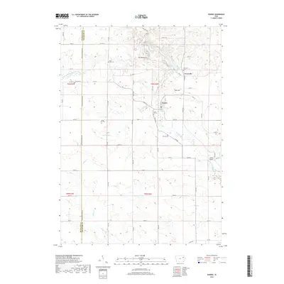
2018 Map of Dundee
USGS Topo · Published 2018About this map
Dundee sits as the central hub of this eastern Iowa landscape, where agricultural grid lines meet the winding courses of the Maquoketa River and its various tributaries. The terrain transitions from the steady elevation of Wolf Hill to the distinctive topographic formation known as The Backbone in the north. This area is notably dense with small, local burial grounds that reflect the early settlement patterns of Delaware and Buchanan counties, including Saint Albert Cem, Forestville Cem, and the Stanger Farm Cem. To the northeast, the village of Forestville marks a historic crossing point near the river. The map also traces the drainage network formed by Sand Hagen Cr, Coffins Cr, and Rieger Cr, illustrating how the natural hydrology dictated the placement of early infrastructure like the Lindsey Bridge and the winding route of State Hwy 410.
Find a feature on this map
55 named features on this map. Tap any name to fly to it.
Don’t see what you’re looking for? This feature index may not catch every label — zoom into the map to look around manually.
Map Details
Editions of this 2018 Dundee Map
This is the sole edition of this map. No revisions or reprints were ever made.
Other maps of this area

1900 · Anamosa
USGS Topo · 1:125,000

1901 · Oelwein
USGS Topo · 1:125,000

1902 · Elkader
USGS Topo · 1:125,000

1903 · Winthrop
USGS Topo · 1:125,000

1959 · Dubuque
USGS Topo · 1:250,000

1961 · Dubuque
USGS Topo · 1:250,000

1962 · Dubuque
USGS Topo · 1:250,000

1964 · Edgewood
USGS Topo · 1:24,000

1965 · Thorpe
USGS Topo · 1:24,000

1965 · Strawberry Point
USGS Topo · 1:24,000