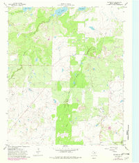
1964 Map of Dundee SE
USGS Topo · Published 1982About this map
The Little Wichita River and its Middle Fork carve through the North Texas landscape shown in this photogrammetric survey, which was updated through the early 1980s. The region is characterized by significant petroleum development, most notably within the Oldham Oil Field, where numerous sites are marked as Oil Well and Drill Hole. This industrial activity is balanced by large-scale water management projects, including the sprawling southern reaches of Lake Kickapoo.
Find a feature on this map
10 named features on this map. Tap any name to fly to it.
Don’t see what you’re looking for? This feature index may not catch every label — zoom into the map to look around manually.
Map Details
Editions of this 1964 Dundee SE Map
2 editions found
Other maps of this area

1931 · Archer City
USGS Topo · 1:62,500

1932 · Dundee
USGS Topo · 1:62,500

1954 · Wichita Falls
USGS Topo · 1:250,000

1958 · Wichita Falls
USGS Topo · 1:250,000

1963 · Dundee
USGS Topo · 1:24,000

1963 · Dundee SW
USGS Topo · 1:24,000

1963 · Megargel
USGS Topo · 1:24,000

1964 · Bobcat Bluff
USGS Topo · 1:24,000

1964 · Dundee SE
USGS Topo · 1:24,000

1964 · Archer City West
USGS Topo · 1:24,000