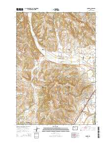
2014 Map of Dundee
USGS Topo · Published 2014About this map
The Red Hills of Dundee and the Chehalem Mountains dominate this landscape, illustrating the intricate topography of Oregon's wine country. The settlement of Dundee sits at the base of these hills, while Lafayette is positioned to the southwest, both connected by a network of rural roads and the Portland & Western RR. This map reveals a high concentration of private water resources, including E R Baker Reservoir, Tangen Reservoir, and Kuehne Reservoir, which support the region's agricultural vitality.
Find a feature on this map
121 named features on this map. Tap any name to fly to it.
Don’t see what you’re looking for? This feature index may not catch every label — zoom into the map to look around manually.
Map Details
Editions of this 2014 Dundee Map
This is the sole edition of this map. No revisions or reprints were ever made.
Other maps of this area

1916 · Tualatin
USGS Topo · 1:62,500

1923 · Mount Angel
USGS Topo · 1:62,500

1924 · Mc Minnville
USGS Topo · 1:48,000

1926 · Mc Minnville
USGS Topo · 1:62,500

1939 · Tualatin
USGS Topo · 1:62,500

1940 · McMinnville
USGS Topo · 1:62,500

1940 · Tualatin
USGS Topo · 1:62,500

1940 · Mount Angel
USGS Topo · 1:62,500

1941 · Yamhill
USGS Topo · 1:62,500

1942 · Yamhill
USGS Topo · 1:62,500