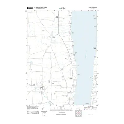
2010 Map of Dundee
USGS Topo · Published 2010About this map
Seneca Lake defines the eastern boundary of this Yates County landscape, where the viticulture of the Finger Lakes region is clearly established at Glenora Wine Cellars, Miles Wine Cellars, and Silver Thread Vineyard. The settlement of Dundee serves as a local hub, surrounded by smaller communities such as Himrod, Starkey, and Lakemont. Genealogists will find a high density of burial sites throughout the area, including the Old Baptist Cemetery, Old Presbyterian Cemetery, and Grove Mount Cemetery. The terrain transitions from the shoreline at Ross Point and Valois Point to the agricultural uplands where Deleonawba Farm and Zephyr Knolls Farm are located. Private aviation is supported by the Dundee Flying Club Airport and Greenlawn Farm Airport, reflecting a mix of traditional farming and modern infrastructure.
Find a feature on this map
87 named features on this map. Tap any name to fly to it.
Don’t see what you’re looking for? This feature index may not catch every label — zoom into the map to look around manually.
Map Details
Editions of this 2010 Dundee Map
This is the sole edition of this map. No revisions or reprints were ever made.
Other maps of this area

1898 · Watkins Glen
USGS Topo · 1:62,500

1901 · Watkins
USGS Topo · 1:62,500

1902 · Ovid
USGS Topo · 1:62,500

1903 · Penn Yan
USGS Topo · 1:62,500

1903 · Hammondsport
USGS Topo · 1:62,500

1905 · Watkins Glen
USGS Topo · 1:125,000

1942 · Penn Yan
USGS Topo · 1:31,680

1942 · Ovid
USGS Topo · 1:31,680

1942 · Dundee
USGS Topo · 1:24,000

1942 · Lodi
USGS Topo · 1:24,000