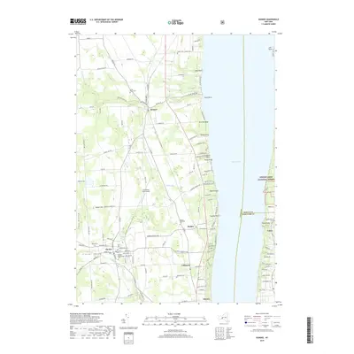
2019 Map of Dundee
USGS Topo · Published 2019About this map
Dundee serves as the primary hub of this landscape, situated at the confluence of Big Stream and several local routes like Co RD 11. The village's history is well-preserved through its concentration of burial sites, including Old Baptist Cem and Dundee Presbyterian Cem. To the east, the terrain descends toward the western shore of Seneca Lake, where numerous named points like Starkey Point and Severne Point define a shoreline lined with private landings and cottages.
Find a feature on this map
137 named features on this map. Tap any name to fly to it.
Don’t see what you’re looking for? This feature index may not catch every label — zoom into the map to look around manually.
Map Details
Editions of this 2019 Dundee Map
This is the sole edition of this map. No revisions or reprints were ever made.
Other maps of this area

1898 · Watkins Glen
USGS Topo · 1:62,500

1901 · Watkins
USGS Topo · 1:62,500

1902 · Ovid
USGS Topo · 1:62,500

1903 · Penn Yan
USGS Topo · 1:62,500

1903 · Hammondsport
USGS Topo · 1:62,500

1905 · Watkins Glen
USGS Topo · 1:125,000

1942 · Penn Yan
USGS Topo · 1:31,680

1942 · Ovid
USGS Topo · 1:31,680

1942 · Dundee
USGS Topo · 1:24,000

1942 · Lodi
USGS Topo · 1:24,000