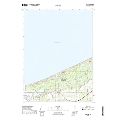
2019 Map of Dune Acres
USGS Topo · Published 2019About this map
Indiana Dunes National Park dominates this 2019 survey, protecting a complex landscape of shifting sands and wetlands along the Lake Michigan shoreline. The map reveals the intricate topographical relief of the dunes, specifically Mt Holden, Mt Tom, and Mt Jackson, which stand as prominent natural landmarks overlooking the lake. At the base of these heights, the vast expanse of Cowles Bog serves as a critical ecological focal point, crisscrossed by the Cowles Bog Trail with Greenbelt and other primitive routes like Trail 10 and the Calumet Trail.
Find a feature on this map
63 named features on this map. Tap any name to fly to it.
Don’t see what you’re looking for? This feature index may not catch every label — zoom into the map to look around manually.
Map Details
Editions of this 2019 Dune Acres Map
This is the sole edition of this map. No revisions or reprints were ever made.
Other maps of this area

1934 · Porter
USGS Topo · 1:48,000

1940 · Porter
USGS Topo · 1:62,500

1953 · Garyton
USGS Topo · 1:24,000

1953 · Westville
USGS Topo · 1:24,000

1953 · Ogden Dunes
USGS Topo · 1:24,000

1953 · Chesterton
USGS Topo · 1:24,000

1953 · Dune Acres
USGS Topo · 1:24,000

1953 · Michigan City West
USGS Topo · 1:24,000

1953 · Chicago
USGS Topo · 1:250,000

1957 · Chicago
USGS Topo · 1:250,000