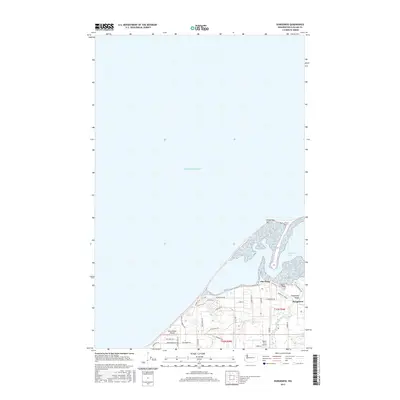
2017 Map of Dungeness
USGS Topo · Published 2017About this map
Old Town and the settlement of Dungeness anchor this coastal landscape where the Dungeness River meets the Puget Sound. The map illustrates a transitional geography between the maritime environment of Dungeness Bay and the agricultural expanse of the Dungeness Valley. Local infrastructure is defined by a network of rural roads such as Lotzgesell Rd and Kitchen Dick Rd, alongside recreational paths like the Horse Trail and People Trail. This 2017 survey captures the area's long-standing aviation character, featuring both Blue Ribbon Airport and Rake's Glen Airport. The prominent arc of the Dungeness Spit creates a sheltered harbor, while inland, the terrain is drained by Matriotti Cr, showing the established drainage and land division patterns of Townships 30 and 31 North.
Find a feature on this map
37 named features on this map. Tap any name to fly to it.
Don’t see what you’re looking for? This feature index may not catch every label — zoom into the map to look around manually.
Map Details
Editions of this 2017 Dungeness Map
This is the sole edition of this map. No revisions or reprints were ever made.
Other maps of this area

1918 · Port Angeles
USGS Topo · 1:62,500

1938 · Dungeness
USGS Topo · 1:62,500

1939 · Dungeness
USGS Topo · 1:62,500

1941 · Port Angeles
USGS Topo · 1:62,500

1956 · Sequim
USGS Topo · 1:24,000
1956 · Carlsborg
USGS Topo · 1:24,000
1956 · Morse Creek
USGS Topo · 1:24,000

1957 · Victoria
USGS Topo · 1:250,000
1961 · Morse Creek
USGS Topo · 1:24,000
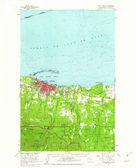
1961 · Port Angeles
USGS Topo · 1:62,500