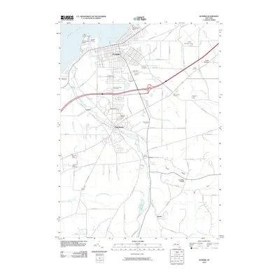
2010 Map of Dunkirk
USGS Topo · Published 2010About this map
Dunkirk and Fredonia anchor this coastal survey, where the urban grid meets the agricultural hinterlands of Chautauqua County. The industrial and maritime character of the lakefront is defined by Dunkirk Harbor, protected by the Dunkirk Light at Point Gratiot. Inland, the landscape transitions from the campus of the State University of New York at Fredonia to the orchards and vineyards of Woodbury Fruit Farms and Mancuso Farm.
Find a feature on this map
105 named features on this map. Tap any name to fly to it.
Don’t see what you’re looking for? This feature index may not catch every label — zoom into the map to look around manually.
Map Details
Editions of this 2010 Dunkirk Map
This is the sole edition of this map. No revisions or reprints were ever made.
Other maps of this area

1899 · Silver Creek
USGS Topo · 1:62,500

1900 · Dunkirk
USGS Topo · 1:62,500

1900 · Cherry Creek
USGS Topo · 1:62,500

1941 · Cherry Creek
USGS Topo · 1:62,500

1943 · Dunkirk
USGS Topo · 1:62,500

1943 · Silver Creek
USGS Topo · 1:24,000

1944 · Silver Creek
USGS Topo · 1:31,680
1954 · Hamlet
USGS Topo · 1:24,000

1954 · Forestville
USGS Topo · 1:24,000
1954 · Dunkirk
USGS Topo · 1:24,000