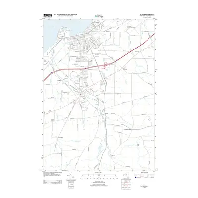
2013 Map of Dunkirk
USGS Topo · Published 2013About this map
Point Gratiot and the historic Dunkirk Light anchor the Lake Erie shoreline, where beaches like Wright Park Beach meet the residential and institutional core of the region. The landscape transitions from the urbanized lakefront south into the hills of the Chautauqua County interior, following the winding path of Canadaway Creek. This drainage is marked by natural features like Shumla Falls and the Fredonia Reservoir, alongside agricultural operations such as Mancuso Farm and Militello Farms.
Find a feature on this map
186 named features on this map. Tap any name to fly to it.
Don’t see what you’re looking for? This feature index may not catch every label — zoom into the map to look around manually.
Map Details
Editions of this 2013 Dunkirk Map
This is the sole edition of this map. No revisions or reprints were ever made.
Other maps of this area

1899 · Silver Creek
USGS Topo · 1:62,500

1900 · Dunkirk
USGS Topo · 1:62,500

1900 · Cherry Creek
USGS Topo · 1:62,500

1941 · Cherry Creek
USGS Topo · 1:62,500

1943 · Dunkirk
USGS Topo · 1:62,500

1943 · Silver Creek
USGS Topo · 1:24,000

1944 · Silver Creek
USGS Topo · 1:31,680
1954 · Hamlet
USGS Topo · 1:24,000

1954 · Forestville
USGS Topo · 1:24,000
1954 · Dunkirk
USGS Topo · 1:24,000