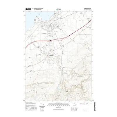
2016 Map of Dunkirk
USGS Topo · Published 2016About this map
Lake Erie defines the northern edge of this Lake Erie landscape, where the port city of Dunkirk and the village of Fredonia sit atop a network of coastal creeks. The terrain rises sharply away from the lakefront beaches like Wright Park Beach and Point Gratiot Beach, following the winding course of Canadaway Creek southward toward the Fredonia Reservoir. This modern record captures the dense institutional and civic footprint of the region, including the expansive campus of SUNY at Fredonia and numerous burial grounds such as Forest Hill Cem and Saint Marys Cem. Small inland hamlets like Laona, Shumla, and Cordova are connected by a web of rural routes like Chautauqua RD and Co Touring Rte 80, reflecting a geography shaped by both the Great Lakes shoreline and the agricultural uplands of Chautauqua County.
Find a feature on this map
52 named features on this map. Tap any name to fly to it.
Don’t see what you’re looking for? This feature index may not catch every label — zoom into the map to look around manually.
Map Details
Editions of this 2016 Dunkirk Map
This is the sole edition of this map. No revisions or reprints were ever made.
Other maps of this area

1899 · Silver Creek
USGS Topo · 1:62,500

1900 · Dunkirk
USGS Topo · 1:62,500

1900 · Cherry Creek
USGS Topo · 1:62,500

1941 · Cherry Creek
USGS Topo · 1:62,500

1943 · Dunkirk
USGS Topo · 1:62,500

1943 · Silver Creek
USGS Topo · 1:24,000

1944 · Silver Creek
USGS Topo · 1:31,680
1954 · Hamlet
USGS Topo · 1:24,000

1954 · Forestville
USGS Topo · 1:24,000
1954 · Dunkirk
USGS Topo · 1:24,000