2023 Map of Dunkirk
USGS Topo · Published 2023About this map
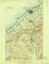
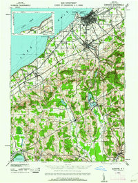
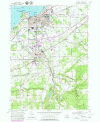
Lake Erie defines the northern edge of this coastal landscape, where the port city of Dunkirk and the village of Fredonia have expanded into a contiguous residential and educational corridor. The presence of SUNY Fredonia and the Chautauqua County/ Dunkirk Airport highlights the area's modern infrastructure, while a dense network of older sites like Forest Hill Cem and Saint Marys Cem points to long-established community roots. Southward, the terrain rises into the highlands where Canadaway Creek carves through the landscape toward Shumla and the Fredonia Reservoir. This geography reveals a clear transition from the industrial and transport-heavy lakeshore, marked by the Norfolk Southern rail line, to the rural topography of Dutch Hollow and the falls at Arkwright Falls.
Find a feature on this map
72 named features on this map. Tap any name to fly to it.
Don’t see what you’re looking for? This feature index may not catch every label — zoom into the map to look around manually.
Map Details
Editions of this 2023 Dunkirk Map
This is the sole edition of this map. No revisions or reprints were ever made.
Historical Maps of Laona Through Time
4 maps found