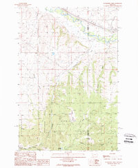
1989 Map of Dunkleberg Creek
USGS Topo · Published 1989About this map
Mining and timber operations define the landscape along the border of Granite and Powell Counties in the late 1980s. High-altitude extraction is evident through numerous Mine Shafts, Adits, and Prospects scattered across the ridges, most notably the Forest Rose Mine situated above Dunkleberg Creek. The presence of the Douglas Creek GS Station and the sprawling Deerlodge National Forest boundary indicates the area's importance for land management and resource protection during this era.
Find a feature on this map
27 named features on this map. Tap any name to fly to it.
Don’t see what you’re looking for? This feature index may not catch every label — zoom into the map to look around manually.
Map Details
Editions of this 1989 Dunkleberg Creek Map
This is the sole edition of this map. No revisions or reprints were ever made.
Other maps of this area

1889 · Helena
USGS Topo · 1:250,000

1893 · Helena
USGS Topo · 1:250,000

1899 · Helena
USGS Topo · 1:250,000

1903 · Helena
USGS Topo · 1:250,000

1908 · Philipsburg
USGS Topo · 1:125,000

1919 · Drummond
USGS Topo · 1:125,000

1921 · Drummond
USGS Topo · 1:125,000

1947 · Butte
USGS Topo · 1:250,000

1958 · Butte
USGS Topo · 1:250,000

1958 · Drummond
USGS Topo · 1:62,500