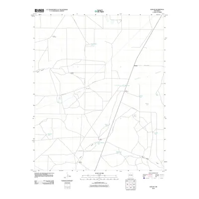
2010 Map of Dunlap
USGS Topo · Published 2010About this map
Arroyo Mora carves through the arid landscape of De Baca County, defining the drainage patterns that support the sparse ranching infrastructure of this region. In an area where water is the primary currency for survival, the presence of Mora Springs and numerous catchment basins like Horse Pasture Tank and Grasshopper Tank indicate the vital relationship between the terrain and livestock operations. The map reveals a network of county roads connecting isolated outposts such as Key Ranch and Martin Ranch to the small community center of Dunlap.
Find a feature on this map
28 named features on this map. Tap any name to fly to it.
Don’t see what you’re looking for? This feature index may not catch every label — zoom into the map to look around manually.
Map Details
Editions of this 2010 Dunlap Map
This is the sole edition of this map. No revisions or reprints were ever made.
Other maps of this area

1954 · Fort Sumner
USGS Topo · 1:250,000

1955 · Roswell
USGS Topo · 1:250,000

1958 · Fort Sumner
USGS Topo · 1:250,000

1958 · Roswell
USGS Topo · 1:250,000

1962 · Roswell
USGS Topo · 1:250,000

1967 · Dunlap NE
USGS Topo · 1:24,000

1967 · Dunlap Sill
USGS Topo · 1:24,000

1967 · Conejo Creek West
USGS Topo · 1:24,000

1967 · Swallow Nest Canyon
USGS Topo · 1:24,000

1967 · Devils Well
USGS Topo · 1:24,000