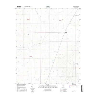
2017 Map of Dunlap
USGS Topo · Published 2017About this map
The settlement of Dunlap sits at the intersection of Diamond Rd and Gem Rd in this De Baca County landscape. This high plains environment is defined by its water management, visible through a network of named stock tanks such as Grasshopper Tank, Shirley Tank, and Horse Pasture Tank. These man-made features are essential infrastructure for ranching in the arid New Mexico climate. Natural drainages like Arroyo Mora, which is fed by Mora Springs, cut through the terrain alongside prominent features like Rock Canyon and Lovelady Draw. The map reveals the grid-like Public Land Survey System divisions, including t2s r22e and t3s r23e, which guided the parceling of this territory. In the southeastern corner, Wylie Draw provides another notable topographic landmark in a region where local roads like Cowchip Rd and Bootheel Rd connect isolated outposts.
Find a feature on this map
27 named features on this map. Tap any name to fly to it.
Don’t see what you’re looking for? This feature index may not catch every label — zoom into the map to look around manually.
Map Details
Editions of this 2017 Dunlap Map
This is the sole edition of this map. No revisions or reprints were ever made.
Other maps of this area

1954 · Fort Sumner
USGS Topo · 1:250,000

1955 · Roswell
USGS Topo · 1:250,000

1958 · Fort Sumner
USGS Topo · 1:250,000

1958 · Roswell
USGS Topo · 1:250,000

1962 · Roswell
USGS Topo · 1:250,000

1967 · Dunlap NE
USGS Topo · 1:24,000

1967 · Dunlap Sill
USGS Topo · 1:24,000

1967 · Conejo Creek West
USGS Topo · 1:24,000

1967 · Swallow Nest Canyon
USGS Topo · 1:24,000

1967 · Devils Well
USGS Topo · 1:24,000