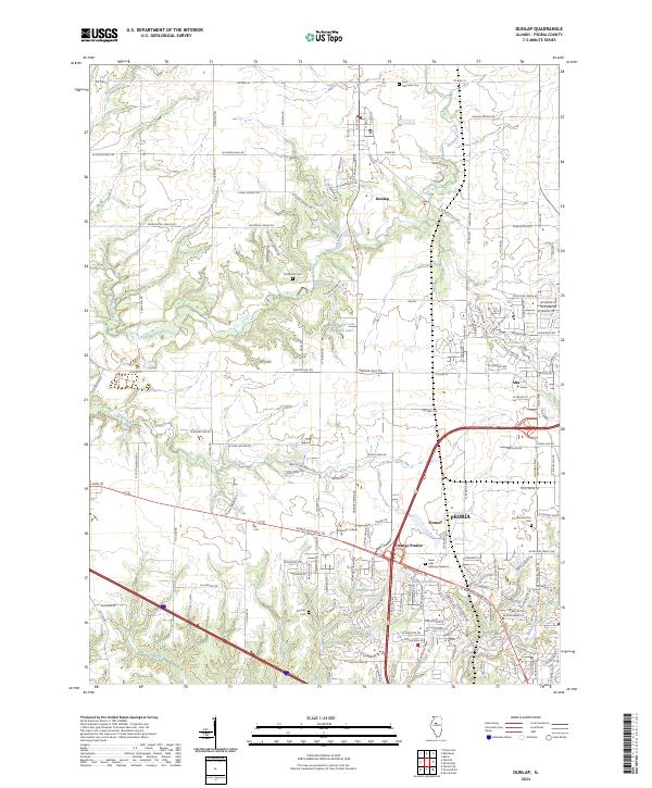
2024 Map of Dunlap
USGS Topo · Published 2024About this map
Dunlap serves as a central hub in this modern survey of Peoria County, where the transition from agricultural land to residential suburban development is clearly visible. The landscape is defined by the winding course of Kickapoo Creek and its many tributaries, including Hickory Run, N Nettle Creek, and Fargo Run. These waterways break up the grid of established county roads such as W Brimfield Jubilee Rd and Co Hwy 31. The southern portion of the map reveals the expanding northern reaches of Peoria, including the communities of Orange Prairie and Pioneer. Educational and memorial sites are frequent throughout the area, from the campus of Methodist College to long-standing local burial grounds like Dickinson Cem and the expansive Swan Lake Memory Gardens. Small lakes and ponds, such as the Radnor Rod and Gun Club Lake, are scattered across the terrain, reflecting the area's recreational geography.
Find a feature on this map
76 named features on this map. Tap any name to fly to it.
Don’t see what you’re looking for? This feature index may not catch every label — zoom into the map to look around manually.
Map Details
Editions of this 2024 Dunlap Map
This is the sole edition of this map. No revisions or reprints were ever made.
Other maps of this area

1893 · Dunlap
USGS Topo · 1:62,500

1898 · Dunlap
USGS Topo · 1:62,500

1905 · Peoria
USGS Topo · 1:62,500

1927 · Peoria
USGS Topo · 1:62,500

1930 · Glasford
USGS Topo · 1:62,500

1932 · Dunlap
USGS Topo · 1:62,500

1933 · Dunlap
USGS Topo · 1:62,500

1937 · Dunlap
USGS Topo · 1:62,500

1944 · Elmwood
USGS Topo · 1:62,500

1948 · Elmwood
USGS Topo · 1:62,500