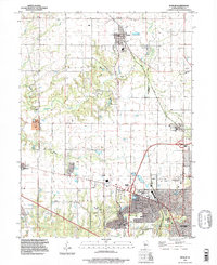
1996 Map of Dunlap
USGS Topo · Published 1997About this map
The northern suburban expansion of Peoria is captured here in the mid-1990s, where the rural character of Radnor and Medina townships meets growing residential developments. The map highlights a significant concentration of local heritage sites, including the St Clements Cem and Dickson Cem, alongside the sprawling grounds of the Swan Lake Memory Gardens Cemetery and Resurrection Cemetery. Educational centers like the Dunlap High Sch and Wilder Waite Sch serve the communities of Dunlap and Alta, while the Rock Island Trail State Park follows a former railroad corridor through the landscape. The drainage patterns of Kickapoo Creek and Big Hollow Creek define the local topography, punctuated by local landmarks like the Grange Hall and the Kellogg Golf Course near the transition into the Richwoods district.
Find a feature on this map
45 named features on this map. Tap any name to fly to it.
Don’t see what you’re looking for? This feature index may not catch every label — zoom into the map to look around manually.
Map Details
Editions of this 1996 Dunlap Map
This is the sole edition of this map. No revisions or reprints were ever made.
Other maps of this area

1893 · Dunlap
USGS Topo · 1:62,500

1898 · Dunlap
USGS Topo · 1:62,500

1905 · Peoria
USGS Topo · 1:62,500

1927 · Peoria
USGS Topo · 1:62,500

1930 · Glasford
USGS Topo · 1:62,500

1932 · Dunlap
USGS Topo · 1:62,500

1933 · Dunlap
USGS Topo · 1:62,500

1937 · Dunlap
USGS Topo · 1:62,500

1944 · Elmwood
USGS Topo · 1:62,500

1948 · Elmwood
USGS Topo · 1:62,500