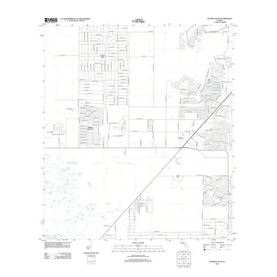
2012 Map of Dunnellon SE
USGS Topo · Published 2012About this map
Ross Prairie anchors the southeastern landscape of this Marion County quadrangle, where modern residential development meets the traditional topography of central Florida. The transition from established communities like Rolling Hills and Rolling Ranches to the expansive natural wetlands is a defining characteristic of the area during this period. To the west, the Marion County Airport and its nearby Beacon Tower indicate the importance of aviation and regional connectivity in the early 21st century.
Find a feature on this map
87 named features on this map. Tap any name to fly to it.
Don’t see what you’re looking for? This feature index may not catch every label — zoom into the map to look around manually.
Map Details
Editions of this 2012 Dunnellon SE Map
This is the sole edition of this map. No revisions or reprints were ever made.
Other maps of this area

1892 · Dunnellon
USGS Topo · 1:62,500

1893 · Panasoffkee
USGS Topo · 1:62,500

1894 · Dunnellon
USGS Topo · 1:62,500

1895 · Tsala Apopka
USGS Topo · 1:62,500

1895 · Panasoffkee
USGS Topo · 1:62,500

1895 · Ocala
USGS Topo · 1:62,500

1954 · Holder
USGS Topo · 1:24,000

1954 · Romeo
USGS Topo · 1:24,000

1954 · Tsala Apopka NE
USGS Topo · 1:24,000

1954 · Dunnellon
USGS Topo · 1:24,000