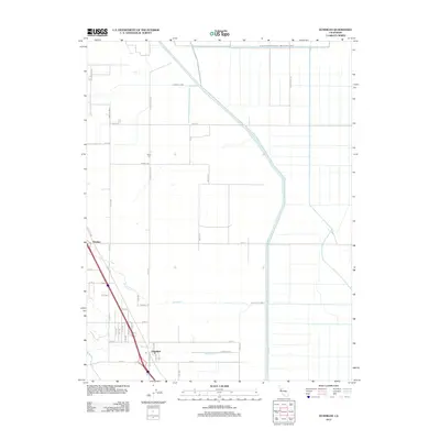
2012 Map of Dunnigan
USGS Topo · Published 2012About this map
Agricultural patterns and irrigation infrastructure define the landscape around Dunnigan in the early 21st century. The town, along with the settlement of Hershey to the northwest, sits at the base of the hills, where the terrain transitions into the flat expanse of the Sacramento Valley. This area is heavily defined by its water management systems, notably the massive Colusa Basin Drainage Canal and the Wilkins Slough Main Irrigation Canal, which service the grid of farmland. For those tracing local history, the Johns Cem and roads like Johns School Rd provide evidence of earlier family names and rural school sites. The path of Old Hwy 99W runs parallel to the modern interstate corridor, marking the historical transit route through this portion of Yolo County. Natural drainage is still visible through seasonal waterways like Buckeye Cr and Dunnigan Cr.
Find a feature on this map
49 named features on this map. Tap any name to fly to it.
Don’t see what you’re looking for? This feature index may not catch every label — zoom into the map to look around manually.
Map Details
Editions of this 2012 Dunnigan Map
This is the sole edition of this map. No revisions or reprints were ever made.
Other maps of this area

1888 · Marysville
USGS Topo · 1:125,000

1891 · Marysville
USGS Topo · 1:125,000

1894 · Marysville
USGS Topo · 1:125,000

1895 · Marysville
USGS Topo · 1:125,000

1905 · Harrington
USGS Topo · 1:24,000

1907 · Dunnigan
USGS Topo · 1:62,500

1907 · Colusa
USGS Topo · 1:62,500

1911 · Grimes
USGS Topo · 1:31,680
1912 · Tisdale Weir
USGS Topo · 1:31,680

1915 · Ronda
USGS Topo · 1:31,680