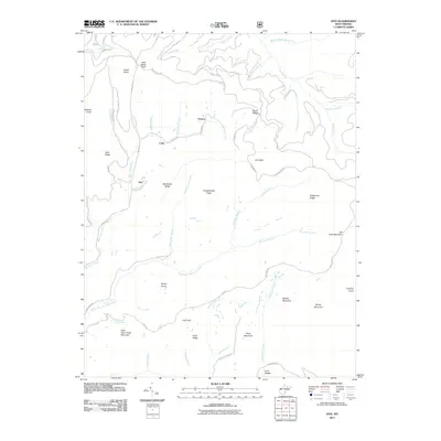
2011 Map of Duo
USGS Topo · Published 2011About this map
Duo and the neighboring settlements of Clearco and Cobb occupy a high-elevation landscape in Greenbrier County where the headwaters of several major creek systems originate. This 2011 survey documents a topography defined by long ridges and isolated peaks, such as Smokehouse Ridge and Beech Ridge, which separate the drainages of Big Clear Creek and its many branches. The map detail highlights the complex network of local roads like Anjean Rd and Clearco Rd that wind through the valleys, connecting the small residential clusters. One of the more distinct natural features is Kuhn Glades in the south, situated near Point Mountain. This area of the Allegheny Mountains is characterized by steep elevation changes, ranging from Wildcat Knob to the broad slopes of Middle Mountain, illustrating the remote and rugged character of this part of West Virginia.
Find a feature on this map
64 named features on this map. Tap any name to fly to it.
Don’t see what you’re looking for? This feature index may not catch every label — zoom into the map to look around manually.
Map Details
Editions of this 2011 Duo Map
This is the sole edition of this map. No revisions or reprints were ever made.
Other maps of this area

1887 · Hinton
USGS Topo · 1:125,000

1887 · Lewisburg
USGS Topo · 1:125,000

1889 · Nicholas
USGS Topo · 1:125,000

1891 · Lewisburg
USGS Topo · 1:125,000

1891 · Nicholas
USGS Topo · 1:125,000

1891 · Huntersville
USGS Topo · 1:125,000

1892 · Hinton
USGS Topo · 1:125,000

1894 · Huntersville
USGS Topo · 1:125,000

1901 · Nicholas
USGS Topo · 1:125,000

1918 · Richwood
USGS Topo · 1:62,500