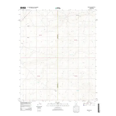
2013 Map of Duran NE
USGS Topo · Published 2013About this map
Duran anchors the northwestern corner of this New Mexico landscape, situated along the path of Us-54 N. The topography is defined by the high-desert drainages of Tall Pine Draw and Marino Draw, which illustrate the natural water-flow patterns across the Torrance and Guadalupe county line. For those researching local family histories or land use, the map identifies private agricultural operations such as Hindi Ranch and A Hindi Ranch in the southern portion of the quadrangle. The inclusion of the Duran Cem provides a specific point of interest for genealogical study, while named water features like Indio Tank and the Laguna de las Vacas suggest the vital role of seasonal and permanent water sources in this arid environment.
Find a feature on this map
14 named features on this map. Tap any name to fly to it.
Don’t see what you’re looking for? This feature index may not catch every label — zoom into the map to look around manually.
Map Details
Editions of this 2013 Duran NE Map
This is the sole edition of this map. No revisions or reprints were ever made.
Other maps of this area

1954 · Fort Sumner
USGS Topo · 1:250,000

1958 · Fort Sumner
USGS Topo · 1:250,000

1978 · Vaughn
USGS Topo · 1:24,000

1978 · Tejon
USGS Topo · 1:24,000

1978 · Dunlap Ranch
USGS Topo · 1:24,000

1980 · Corona
USGS Topo · 1:100,000

1981 · Gacho Hill NW
USGS Topo · 1:24,000

1981 · Gacho Hill SW
USGS Topo · 1:24,000

1981 · Camaleon Draw West
USGS Topo · 1:24,000
1981 · Duran
USGS Topo · 1:24,000