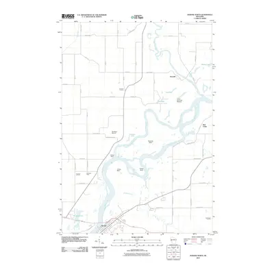
2010 Map of Durand North
USGS Topo · Published 2010About this map
The Chippewa River dominates this portion of Wisconsin, winding through a complex network of wetlands and riverine features south of Dunnville. The landscape is defined by the shifting waters of Ninemile Slough, which create landforms like Ninemile Island, Cranes Bend, and Snaggy Bend. Along the riverbanks, the Yellow Bank and the prominent Waubeek Mound provide distinctive elevation in an otherwise low-lying fluvial environment. The Lower Dunnville Bottoms suggest a history of seasonal flooding and rich alluvial soil that shaped early land use in the area.
Find a feature on this map
54 named features on this map. Tap any name to fly to it.
Don’t see what you’re looking for? This feature index may not catch every label — zoom into the map to look around manually.
Map Details
Editions of this 2010 Durand North Map
This is the sole edition of this map. No revisions or reprints were ever made.
Other maps of this area

1929 · Durand
USGS Topo · 1:62,500

1932 · Durand
USGS Topo · 1:62,500

1935 · Arkansaw
USGS Topo · 1:48,000

1940 · Menomonie
USGS Topo · 1:62,500

1941 · Arkansaw
USGS Topo · 1:62,500

1942 · Arkansaw
USGS Topo · 1:62,500

1942 · Menomonie
USGS Topo · 1:62,500

1946 · Knapp
USGS Topo · 1:62,500

1949 · Knapp
USGS Topo · 1:62,500

1953 · Saint Paul
USGS Topo · 1:250,000