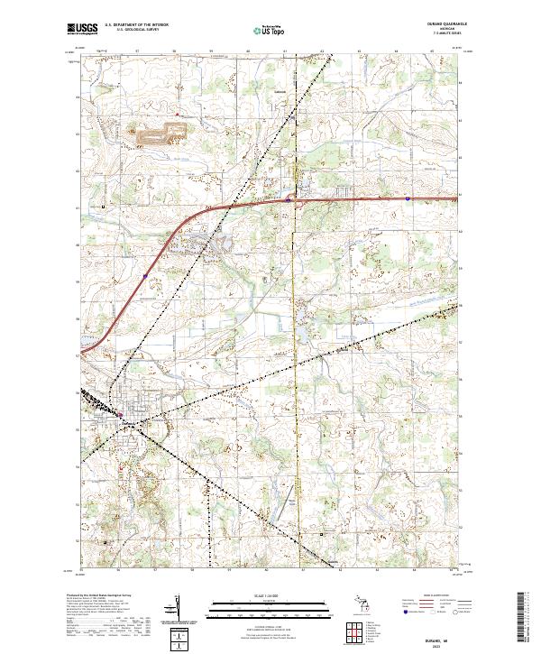
2023 Map of Durand
USGS Topo · Published 2023About this map
The railroad town of Durand serves as the focal point of this modern topographic survey, illustrating the complex drainage network of rural Shiawassee and Genesee counties. Historically a vital rail junction, the landscape surrounding Durand is defined by a dense system of agricultural drains and creeks, including Mikan Drain, Lennon Drain, and Misteguay Creek. The transition between townships is marked by the presence of small settlements like Lennon and Gaines, along with the hamlet of Duffield. For those tracing local heritage, several historic burial grounds are noted, such as Yerian Cem and Lovejoy Cem, providing anchors for genealogical research. The map also highlights Waite Field and the intricate road network branching from E Corunna Rd and S Durand Rd, showing how modern infrastructure follows the long-established section lines of mid-Michigan.
Find a feature on this map
84 named features on this map. Tap any name to fly to it.
Don’t see what you’re looking for? This feature index may not catch every label — zoom into the map to look around manually.
Map Details
Editions of this 2023 Durand Map
This is the sole edition of this map. No revisions or reprints were ever made.
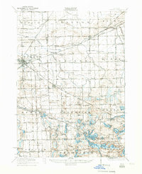
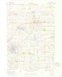
Historical Maps of Vernon Township Through Time
4 maps found