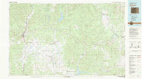
1983 Map of Durango
USGS Topo · Published 1983About this map
Durango serves as the regional hub for this 1980s landscape, where the historic Durango & Silverton Narrow Gauge Railroad heads north into the San Juan National Forest. The map captures a transition from the agricultural plateaus of Florida Mesa and Montezuma Mesa to the high wilderness areas of the Weminuche Wilderness. Key water management features such as Vallecito Reservoir, Lemon Reservoir, and the northern reach of Navajo Reservoir define the local hydrology, while the Southern Ute Indian Reservation spans the southern portion of the sheet. Researchers can find numerous small settlements like Gem Village, Ignacio, and the rail-oriented Pagosa Junction (Gato). This edition reflects the region's mid-century development, showing the expansion of Fort Lewis College and the Durango-La Plata Co Airport alongside traditional ranching and mountain landscapes.
Find a feature on this map
98 named features on this map. Tap any name to fly to it.
Don’t see what you’re looking for? This feature index may not catch every label — zoom into the map to look around manually.
Map Details
Editions of this 1983 Durango Map
This is the sole edition of this map. No revisions or reprints were ever made.
Other maps of this area

1889 · Largo
USGS Topo · 1:250,000

1889 · Chaco
USGS Topo · 1:250,000

1892 · Chaco
USGS Topo · 1:250,000

1895 · Largo
USGS Topo · 1:250,000

1895 · La Plata
USGS Topo · 1:62,500

1897 · La Plata
USGS Topo · 1:62,500

1897 · Rico
USGS Topo · 1:62,500

1898 · Durango
USGS Topo · 1:62,500

1898 · Engineer Mountain
USGS Topo · 1:62,500

1898 · Rico
USGS Topo · 1:62,500