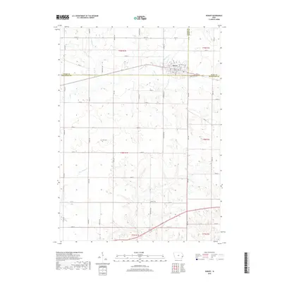
2018 Map of Durant
USGS Topo · Published 2018About this map
Durant sits at the intersection of Cedar, Scott, and Muscatine Counties, serving as a focal point for the surrounding agricultural landscape in this 2018 survey. The town's grid is well-defined by streets such as 5th St and 8th St, while the outskirts are marked by a transition from residential blocks to an extensive network of country roads like Thayer Ave and Vail Ave. For those researching local families, the map identifies several burial grounds including Durant Cem, Doran Cem, and Melpine Cem, which are scattered throughout the rural sections.
Find a feature on this map
56 named features on this map. Tap any name to fly to it.
Don’t see what you’re looking for? This feature index may not catch every label — zoom into the map to look around manually.
Map Details
Editions of this 2018 Durant Map
This is the sole edition of this map. No revisions or reprints were ever made.
Other maps of this area

1890 · Durant
USGS Topo · 1:62,500

1891 · Wilton Junction
USGS Topo · 1:62,500

1894 · Durant
USGS Topo · 1:62,500

1901 · Rock Island
USGS Topo · 1:125,000

1901 · Stanwood
USGS Topo · 1:125,000

1910 · Rock Island
USGS Topo · 1:125,000

1916 · Edgington
USGS Topo · 1:62,500

1938 · Edgington
USGS Topo · 1:62,500

1948 · Muscatine
USGS Topo · 1:62,500

1953 · Wilton Junction
USGS Topo · 1:24,000