2022 Map of Durant
USGS Topo · Published 2022About this map
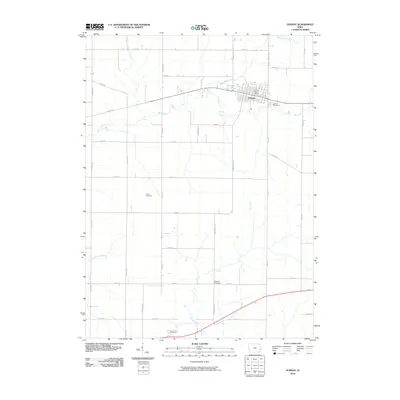
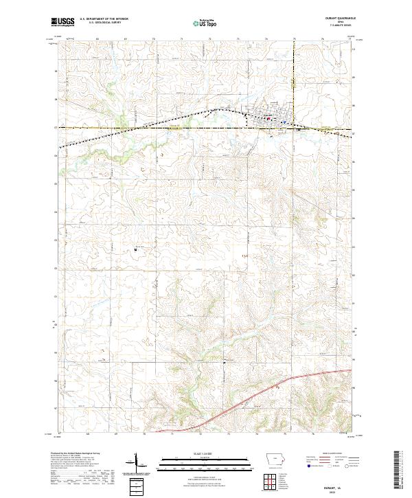
The town of Durant sits at the tri-county corner where Cedar, Scott, and Muscatine counties meet, serving as the primary hub for this fertile Iowa agricultural landscape. This modern survey illustrates the organized township system with its strict grid of rural roads like 120th St and 150th St crossing the diverse network of waterways that drain the region. Numerous creeks, including Little Elkhorn Creek, Big Elkhorn Creek, and Mud Creek, weave between the farm plots, while Pine Creek moves southward toward the Muscatine County line. Genealogists can identify several local burial sites scattered across the townships, such as Doran Cemetery west of town and Melpine Cemetery to the south. The transportation infrastructure is anchored by State Highway 927, which follows the historic path of the old railroad corridor through the heart of the settlement.
Find a feature on this map
32 named features on this map. Tap any name to fly to it.
Don’t see what you’re looking for? This feature index may not catch every label — zoom into the map to look around manually.
Map Details
Editions of this 2022 Durant Map
This is the sole edition of this map. No revisions or reprints were ever made.
Historical Maps of Durant Through Time
9 maps found