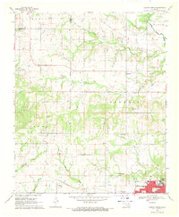
1968 Map of Durant North
USGS Topo · Published 1971About this map
The Indian Treaty Boundary cuts vertically across this landscape, marking a historical divide north of Durant in Bryan County. The city itself occupies the southeast corner, characterized by the campus of Southeastern State College and a grid of residential streets like Waco St and Dallas St. This late-1960s survey documents a rural environment punctuated by the St Louis - San Francisco railroad and the Blue River valley. To the north, the terrain transitions into the Twelvemile Prairie and the rugged heights of Myrick, while smaller communities such as Brown and Kiersey remain connected by the Folsom Highway. Local history is preserved in the locations of Cox Chapel Ch, Mt Zion Ch, and the isolated Keffer Cem, alongside evidence of regional industry such as multiple Gravel Pits and scattered Oil Wells.
Find a feature on this map
42 named features on this map. Tap any name to fly to it.
Don’t see what you’re looking for? This feature index may not catch every label — zoom into the map to look around manually.
Map Details
Editions of this 1968 Durant North Map
This is the sole edition of this map. No revisions or reprints were ever made.
Other maps of this area

1899 · Atoka
USGS Topo · 1:125,000

1900 · Atoka
USGS Topo · 1:125,000

1901 · Tishomingo
USGS Topo · 1:125,000

1901 · Denison
USGS Topo · 1:125,000

1954 · Sherman
USGS Topo · 1:250,000

1957 · Ardmore
USGS Topo · 1:250,000

1958 · Durant
USGS Topo · 1:62,500

1958 · Denison Dam
USGS Topo · 1:62,500

1958 · Sherman
USGS Topo · 1:250,000

1963 · Ardmore
USGS Topo · 1:250,000