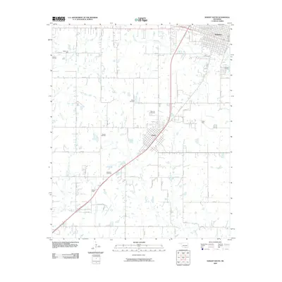
2009 Map of Durant South
USGS Topo · Published 2009About this map
The southern reaches of Durant and the town of Calera are the primary focal points of this 2009 landscape. The area is defined by a series of north-south and east-west rural roads that frame a network of small creeks and bayous. Significant local history is preserved in several burial grounds, including Highland Cemetery on the eastern edge of Durant and the more centrally located Rose Hill Cemetery. The landscape is dotted with several water management features, such as Webb Lake Dam, Harris Lake Dam, and Gordon Lake Dam, which serve the various tributaries like Island Bayou and Mineral Bayou. Aviation activity is represented by Eaker Field and the smaller Boatner Field, while the dense grid of Durant's southern neighborhoods contrasts with the more linear development of Calera along the major transportation corridor.
Find a feature on this map
58 named features on this map. Tap any name to fly to it.
Don’t see what you’re looking for? This feature index may not catch every label — zoom into the map to look around manually.
Map Details
Editions of this 2009 Durant South Map
This is the sole edition of this map. No revisions or reprints were ever made.
Other maps of this area

1899 · Atoka
USGS Topo · 1:125,000

1900 · Atoka
USGS Topo · 1:125,000

1901 · Tishomingo
USGS Topo · 1:125,000

1901 · Denison
USGS Topo · 1:125,000

1954 · Sherman
USGS Topo · 1:250,000

1957 · Denison Dam
USGS Topo · 1:24,000

1957 · Ardmore
USGS Topo · 1:250,000

1958 · Durant
USGS Topo · 1:62,500

1958 · Denison Dam
USGS Topo · 1:62,500

1958 · Sherman
USGS Topo · 1:250,000