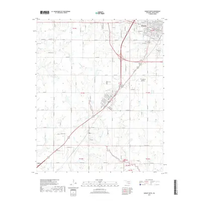
2018 Map of Durant South
USGS Topo · Published 2018About this map
Durant and its southern neighboring communities define this 2018 survey of Bryan County, where the modern regional transportation network intersects with historic land divisions. The settlement of Calera serves as a central hub for the surrounding landscape, flanked by the BNSF Railway which continues to drive the area's logistical importance. Aviation history and local activity are anchored by Durant Regional Airport - Eaker Field and the smaller Boatner Field, while the rural character of the southern portion is marked by the smaller communities of Olive and Colbert.
Find a feature on this map
143 named features on this map. Tap any name to fly to it.
Don’t see what you’re looking for? This feature index may not catch every label — zoom into the map to look around manually.
Map Details
Editions of this 2018 Durant South Map
This is the sole edition of this map. No revisions or reprints were ever made.
Other maps of this area

1899 · Atoka
USGS Topo · 1:125,000

1900 · Atoka
USGS Topo · 1:125,000

1901 · Tishomingo
USGS Topo · 1:125,000

1901 · Denison
USGS Topo · 1:125,000

1954 · Sherman
USGS Topo · 1:250,000

1957 · Denison Dam
USGS Topo · 1:24,000

1957 · Ardmore
USGS Topo · 1:250,000

1958 · Durant
USGS Topo · 1:62,500

1958 · Denison Dam
USGS Topo · 1:62,500

1958 · Sherman
USGS Topo · 1:250,000