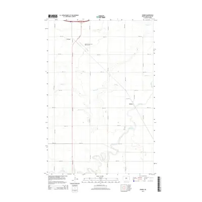
2014 Map of Durbin
USGS Topo · Published 2014About this map
Maple River meanders sharply across the southern portion of this Red River Valley landscape, creating a complex series of oxbows and riparian curves that contrast with the rigid sectional grid of Cass County. This 2014 survey captures the agrarian character of the region, where small settlements like Durbin and Everest serve as focal points for the surrounding farmstead network. The rectilinear alignment of rural roads, including 155th Ave SE and 40th St SE, defines the modern land use patterns common to this part of North Dakota.
Find a feature on this map
23 named features on this map. Tap any name to fly to it.
Don’t see what you’re looking for? This feature index may not catch every label — zoom into the map to look around manually.
Map Details
Editions of this 2014 Durbin Map
This is the sole edition of this map. No revisions or reprints were ever made.
Other maps of this area

1895 · Casselton
USGS Topo · 1:125,000

1897 · Casselton
USGS Topo · 1:125,000

1953 · Fargo
USGS Topo · 1:250,000

1956 · Fargo
USGS Topo · 1:250,000

1959 · Kindred
USGS Topo · 1:24,000

1959 · Leonard
USGS Topo · 1:24,000

1961 · Durbin
USGS Topo · 1:24,000

1961 · Casselton
USGS Topo · 1:24,000
1961 · Casselton SE
USGS Topo · 1:24,000
1961 · Mapleton
USGS Topo · 1:24,000