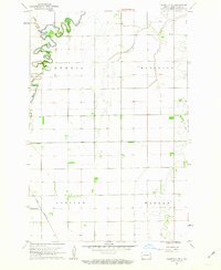
1961 Map of Casselton SE
USGS Topo · Published 1963About this map
Maple River meanders sharply across this eastern North Dakota landscape, carving a deep, winding path through the flat agricultural plains of Cass County. This 1961 survey captures the region's orderly section-line development, where small townships like Addison, Durbin, Mapleton, and Warren define the local geography. The industrial backbone of the area is represented by the Great Northern railroad, which cuts a straight line through the southern portion of the map, providing a vital link for the surrounding farming communities. Evidence of early civic life is found near the intersection of several section roads, where a Townhall and a small Cem (cemetery) are situated. Aside from the river valley and Swan Creek, the terrain is remarkably level, characterized by a network of drainage patterns and field lines that illustrate the intensive land use of the mid-twentieth century.
Find a feature on this map
20 named features on this map. Tap any name to fly to it.
Don’t see what you’re looking for? This feature index may not catch every label — zoom into the map to look around manually.
Map Details
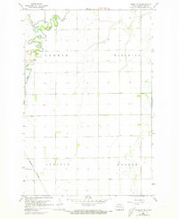
Editions of this 1961 Casselton SE Map
2 editions found
Other maps of this area

1895 · Fargo
USGS Topo · 1:125,000

1895 · Casselton
USGS Topo · 1:125,000

1897 · Fargo
USGS Topo · 1:125,000

1897 · Casselton
USGS Topo · 1:125,000

1953 · Fargo
USGS Topo · 1:250,000

1956 · Fargo
USGS Topo · 1:250,000

1959 · Kindred
USGS Topo · 1:24,000

1959 · Leonard
USGS Topo · 1:24,000

1959 · South West Fargo
USGS Topo · 1:24,000

1959 · West Fargo
USGS Topo · 1:24,000