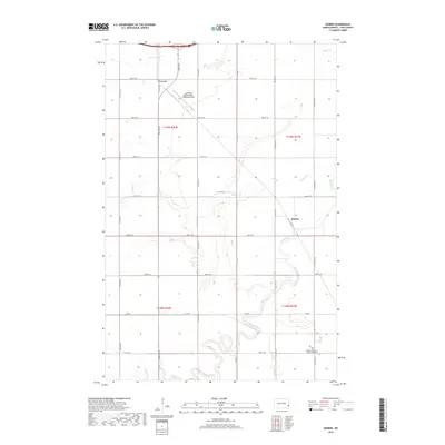
2018 Map of Durbin
USGS Topo · Published 2018About this map
Everest and Durbin anchor this portion of the Red River Valley, where the grid of agricultural section lines is interrupted by the meandering courses of the Maple River and Buffalo Cr. This 2018 survey reveals the persistent rural character of Cass County, defined by a landscape of grain fields and local drainage networks. Local history and genealogy interest is concentrated near the southern boundary at the Canaan Moravian Church Cemetery, a significant community landmark south of Co RD 6. Aviation activity is represented by the Casselton Robert Miller Regional Airport in the northern reach, which occupies a prominent position near the intersection of the county road network and the rail corridor that once fueled the growth of small trackside grain stops like Everest.
Find a feature on this map
19 named features on this map. Tap any name to fly to it.
Don’t see what you’re looking for? This feature index may not catch every label — zoom into the map to look around manually.
Map Details
Editions of this 2018 Durbin Map
This is the sole edition of this map. No revisions or reprints were ever made.
Other maps of this area

1895 · Casselton
USGS Topo · 1:125,000

1897 · Casselton
USGS Topo · 1:125,000

1953 · Fargo
USGS Topo · 1:250,000

1956 · Fargo
USGS Topo · 1:250,000

1959 · Kindred
USGS Topo · 1:24,000

1959 · Leonard
USGS Topo · 1:24,000

1961 · Durbin
USGS Topo · 1:24,000

1961 · Casselton
USGS Topo · 1:24,000
1961 · Casselton SE
USGS Topo · 1:24,000
1961 · Mapleton
USGS Topo · 1:24,000