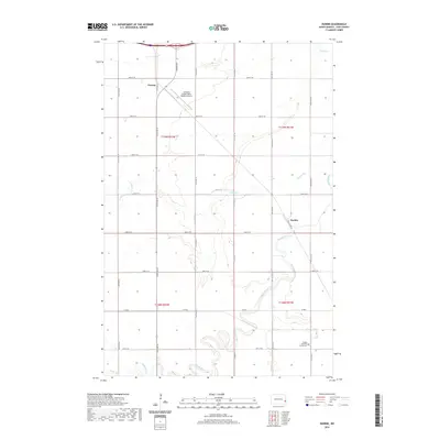
2020 Map of Durbin
USGS Topo · Published 2020About this map
Maple River and its meandering tributaries, Buffalo Cr and Swan Cr, dominate this section of the Red River Valley in Cass County. The landscape is defined by the rigid grid of the Public Land Survey System, which coordinates the region's agricultural infrastructure across townships like t139n r51w and t138n r51w. The settlement of Durbin sits near the banks of the Maple River, while the smaller community of Everest is positioned to the northwest, adjacent to the modern facilities of the Casselton Robert Miller Regional Airport. Local history and genealogy are anchored by the Canaan Moravian Church Cem in the southeastern quadrant, a site that reflects the ethnic and religious settlement patterns of North Dakota's eastern prairies. The map details the extensive network of township roads and county routes, such as Co RD 6 and Co RD 9 S, which have facilitated transport in this farming heartland for generations.
Find a feature on this map
28 named features on this map. Tap any name to fly to it.
Don’t see what you’re looking for? This feature index may not catch every label — zoom into the map to look around manually.
Map Details
Editions of this 2020 Durbin Map
This is the sole edition of this map. No revisions or reprints were ever made.
Other maps of this area

1895 · Casselton
USGS Topo · 1:125,000

1897 · Casselton
USGS Topo · 1:125,000

1953 · Fargo
USGS Topo · 1:250,000

1956 · Fargo
USGS Topo · 1:250,000

1959 · Kindred
USGS Topo · 1:24,000

1959 · Leonard
USGS Topo · 1:24,000

1961 · Durbin
USGS Topo · 1:24,000

1961 · Casselton
USGS Topo · 1:24,000
1961 · Casselton SE
USGS Topo · 1:24,000
1961 · Mapleton
USGS Topo · 1:24,000