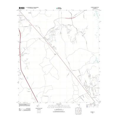
2012 Map of Durbin
USGS Topo · Published 2012About this map
Durbin and Hilden serve as central nodes in this Northeast Florida landscape, where the historic corridor of the Old Dixie Hwy cuts a diagonal path across the terrain. The presence of Durbin Tower along the rail line points to the area's logistical heritage, while the eastern edge of the map is defined by the winding course of the Tolomato River and several of its tributaries, including Sweetwater Cr and Smith Cr.
Find a feature on this map
68 named features on this map. Tap any name to fly to it.
Don’t see what you’re looking for? This feature index may not catch every label — zoom into the map to look around manually.
Map Details
Editions of this 2012 Durbin Map
This is the sole edition of this map. No revisions or reprints were ever made.
Other maps of this area

1917 · Orange Park
USGS Topo · 1:62,500

1918 · Orange Park
USGS Topo · 1:62,500

1918 · Palm Valley
USGS Topo · 1:62,500

1937 · Bakersville
USGS Topo · 1:24,000

1937 · St. Augustine
USGS Topo · 1:24,000

1943 · St. Augustine
USGS Topo · 1:62,500

1947 · Bostwick
USGS Topo · 1:50,000

1948 · Jacksonville
USGS Topo · 1:250,000
1949 · Picolata
USGS Topo · 1:24,000
1949 · Bostwick
USGS Topo · 1:62,500