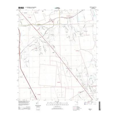
2015 Map of Durbin
USGS Topo · Published 2015About this map
Durbin and Hilden anchor this portion of Northeast Florida, where the boundary between Duval Co and St. Johns Co bisects a landscape defined by coastal wetlands and rapid suburban expansion. The eastern edge is dominated by the Tolomato River and the Intracoastal Waterway, critical arteries for Florida's maritime history. To the west, the map details the headwaters and drainages of Durbin Creek and Sampson Creek, which carve through the low-lying terrain near Big Island. Modern residential developments like Bartram Springs Pky contrast with the long-standing alignment of Old Dixie Hwy, illustrating the transition from traditional rural corridors to contemporary transit networks. The inclusion of Scrub Ridge and Ragged Island provides a detailed look at the area's natural topography before further development might alter these landforms.
Find a feature on this map
129 named features on this map. Tap any name to fly to it.
Don’t see what you’re looking for? This feature index may not catch every label — zoom into the map to look around manually.
Map Details
Editions of this 2015 Durbin Map
This is the sole edition of this map. No revisions or reprints were ever made.
Other maps of this area

1917 · Orange Park
USGS Topo · 1:62,500

1918 · Orange Park
USGS Topo · 1:62,500

1918 · Palm Valley
USGS Topo · 1:62,500

1937 · Bakersville
USGS Topo · 1:24,000

1937 · St. Augustine
USGS Topo · 1:24,000

1943 · St. Augustine
USGS Topo · 1:62,500

1947 · Bostwick
USGS Topo · 1:50,000

1948 · Jacksonville
USGS Topo · 1:250,000
1949 · Picolata
USGS Topo · 1:24,000
1949 · Bostwick
USGS Topo · 1:62,500