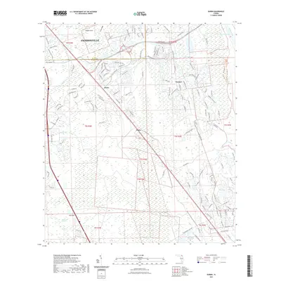
2021 Map of Durbin
USGS Topo · Published 2021About this map
Twelvemile Swamp and the surrounding wetlands dominate this landscape south of Jacksonville, at the boundary where Duval County meets St. Johns County. The area shows a distinct contrast between the rapidly expanding suburban corridors of Nocatee and Durbin and the preserved wild lands of the Twelve Mile Swamp Conservation Area Trail. These conservation efforts protect the intricate hydrology of the region, where numerous waterways like Durbin Creek and Sampson Creek weave through the lowlands. Along the eastern edge, the Intracoastal Waterway and Tolomato River provide a vital maritime passage, separated from the interior by Scrub Ridge. The map captures the recent footprints of modern development alongside older place names like Hilden, illustrating the shifting land use from coastal wetlands to residential communities.
Find a feature on this map
146 named features on this map. Tap any name to fly to it.
Don’t see what you’re looking for? This feature index may not catch every label — zoom into the map to look around manually.
Map Details
Editions of this 2021 Durbin Map
This is the sole edition of this map. No revisions or reprints were ever made.
Other maps of this area

1917 · Orange Park
USGS Topo · 1:62,500

1918 · Orange Park
USGS Topo · 1:62,500

1918 · Palm Valley
USGS Topo · 1:62,500

1937 · Bakersville
USGS Topo · 1:24,000

1937 · St. Augustine
USGS Topo · 1:24,000

1943 · St. Augustine
USGS Topo · 1:62,500

1947 · Bostwick
USGS Topo · 1:50,000

1948 · Jacksonville
USGS Topo · 1:250,000
1949 · Picolata
USGS Topo · 1:24,000
1949 · Bostwick
USGS Topo · 1:62,500