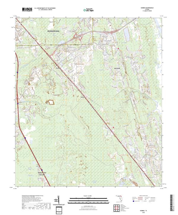
2024 Map of Durbin
USGS Topo · Published 2024About this map
Durbin Swamp and the dense wetlands of the Twelvemile Swamp define the landscape of this portion of St. Johns County. This recent survey records the modern expansion of Jacksonville to the north and the sprawling development of Nocatee to the east, contrasting sharply with the preservation of large Conservation Areas. The Fec railroad remains a central transit spine, running parallel to the corridor through Durbin and Hilden. To the south, the planned community of World Golf Village emerges near the Big Island Swamp, illustrating the transition from traditional Florida wetlands to modern suburban hubs. Navigational features like the Intracoastal Waterway on the eastern edge and the winding course of Durbin Creek highlight the enduring importance of the region's hydrology even as new road networks like Bartram Springs Pkwy and Valley Ridge Blvd reshape the interior.
Find a feature on this map
169 named features on this map. Tap any name to fly to it.
Don’t see what you’re looking for? This feature index may not catch every label — zoom into the map to look around manually.
Map Details
Editions of this 2024 Durbin Map
This is the sole edition of this map. No revisions or reprints were ever made.
Other maps of this area

1917 · Orange Park
USGS Topo · 1:62,500

1918 · Orange Park
USGS Topo · 1:62,500

1918 · Palm Valley
USGS Topo · 1:62,500

1937 · Bakersville
USGS Topo · 1:24,000

1937 · St. Augustine
USGS Topo · 1:24,000

1943 · St. Augustine
USGS Topo · 1:62,500

1947 · Bostwick
USGS Topo · 1:50,000

1948 · Jacksonville
USGS Topo · 1:250,000
1949 · Picolata
USGS Topo · 1:24,000
1949 · Bostwick
USGS Topo · 1:62,500