
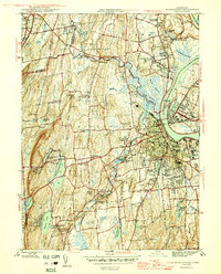
1943 Map of Durham
USGS Topo · Published 1943About this map
The New York New Haven and Hartford railroad cuts through the western gaps of this Connecticut interior, tracing the base of Beseck Mountain and Totoket Mountain. This mid-century survey reveals a landscape of working dairy farms and rugged upland ridges, characterized by the transition from the Mattabesset River valley down into the coastal drainage of the Hammonasset River.
Find a feature on this map
55 named features on this map. Tap any name to fly to it.
Don’t see what you’re looking for? This feature index may not catch every label — zoom into the map to look around manually.
Map Details
Editions of this 1943 Durham Map
This is the sole edition of this map. No revisions or reprints were ever made.
Other maps of this area

1892 · New Haven
USGS Topo · 1:62,500

1892 · Meriden
USGS Topo · 1:62,500

1893 · Guilford
USGS Topo · 1:62,500

1893 · Middletown
USGS Topo · 1:62,500

1893 · Meriden
USGS Topo · 1:62,500

1906 · Farmington
USGS Topo · 1:125,000

1921 · New Haven
USGS Topo · 1:62,500

1928 · Cromwell
USGS Topo · 1:24,000

1945 · Middle Haddam
USGS Topo · 1:31,680
1945 · Middletown
USGS Topo · 1:31,680