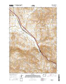
2017 Map of Durkee
USGS Topo · Published 2017About this map
Durkee serves as the focal point of this Eastern Oregon landscape, situated where the corridor of Old US Hwy 30 and the railroad follow the winding course of Pritchard Cr and Durkee Cr. The settlement is closely tied to the surrounding topography of Baker County, with the Durkee Cem positioned northwest of the main cluster. Water management is evident through the presence of the Banks Ditch and the Powell Cr Reservoir, which support ranching operations like those found along Oxman Ranch Ln and Sutter Ranch Rd.
Find a feature on this map
55 named features on this map. Tap any name to fly to it.
Don’t see what you’re looking for? This feature index may not catch every label — zoom into the map to look around manually.
Map Details
Editions of this 2017 Durkee Map
This is the sole edition of this map. No revisions or reprints were ever made.
Other maps of this area

1901 · Baker City
USGS Topo · 1:125,000

1915 · Pine
USGS Topo · 1:125,000

1951 · Huntington
USGS Topo · 1:62,500

1955 · Baker
USGS Topo · 1:250,000

1957 · Durkee
USGS Topo · 1:62,500

1959 · Baker
USGS Topo · 1:250,000

1964 · Bridgeport
USGS Topo · 1:62,500

1967 · Lost Basin
USGS Topo · 1:24,000

1980 · Brogan
USGS Topo · 1:100,000

1981 · Baker
USGS Topo · 1:100,000