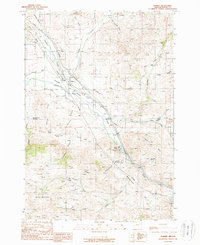
1988 Map of Durkee
USGS Topo · Published 1988About this map
The Burnt River Valley serves as the primary corridor for settlement and industry in this portion of Baker County, where the Union Pacific railroad and major utility lines follow the water's path. The small community of Durkee is a central focal point, featuring a post office and proximity to historical markers like the Cem and Clay Pit Graves. The landscape is defined by its deep mining and ranching roots, evidenced by the Gold Ridge Mine on Gold Ridge and various stock ponds scattered across the higher elevations.
Find a feature on this map
50 named features on this map. Tap any name to fly to it.
Don’t see what you’re looking for? This feature index may not catch every label — zoom into the map to look around manually.
Map Details
Editions of this 1988 Durkee Map
This is the sole edition of this map. No revisions or reprints were ever made.
Other maps of this area

1901 · Baker City
USGS Topo · 1:125,000

1915 · Pine
USGS Topo · 1:125,000

1951 · Huntington
USGS Topo · 1:62,500

1955 · Baker
USGS Topo · 1:250,000

1957 · Durkee
USGS Topo · 1:62,500

1959 · Baker
USGS Topo · 1:250,000

1964 · Bridgeport
USGS Topo · 1:62,500

1967 · Lost Basin
USGS Topo · 1:24,000

1980 · Brogan
USGS Topo · 1:100,000

1981 · Baker
USGS Topo · 1:100,000