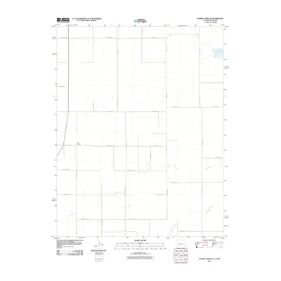
2010 Map of Durkee Creek SE
USGS Topo · Published 2010About this map
Garder Cemetery sits as a lonely landmark in this high plains landscape along the Colorado-Kansas border at the start of the 21st century. The map reveals an orderly, geometric grid of rural transit, defined by corridors such as County Road S and County Road B. This rigid human layout contrasts with the meandering paths of Dry Creek and North Bear Creek, which cut across the southern sections of the quadrangle. The sparse distribution of named features emphasizes the vast agricultural or grazing tracts typical of the Prowers County region, where the intersection of County Road M and County Road P serves as a primary reference point for local landholdings. This 2010 survey provides a precise record of the road network and water resources essential to the rural economy of the Western Great Plains.
Find a feature on this map
19 named features on this map. Tap any name to fly to it.
Don’t see what you’re looking for? This feature index may not catch every label — zoom into the map to look around manually.
Map Details
Editions of this 2010 Durkee Creek SE Map
This is the sole edition of this map. No revisions or reprints were ever made.
Other maps of this area

1891 · Albany
USGS Topo · 1:125,000

1893 · Albany
USGS Topo · 1:125,000

1900 · Syracuse
USGS Topo · 1:125,000

1920 · Syracuse
USGS Topo · 1:125,000

1955 · La Junta
USGS Topo · 1:250,000

1955 · Dodge City
USGS Topo · 1:250,000

1958 · La Junta
USGS Topo · 1:250,000

1958 · Dodge City
USGS Topo · 1:250,000

1959 · Dodge City
USGS Topo · 1:250,000

1966 · Syracuse West SW
USGS Topo · 1:24,000