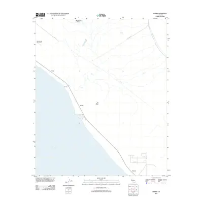
2012 Map of Durmid
USGS Topo · Published 2012About this map
The eastern shoreline of the Salton Sea dominates this 2012 survey, where the desert landscape meets the water's edge at several critical infrastructure points. Small rail-side locations such as Ferrum, Durmid, and Bertram mark the transition between the basin and the arid hills to the east. The presence of the Coachella Canal in the northeast corner highlights the vital role of water management in this Colorado Desert region, while Rancho Dos Palmas serves as a notable landmark of historical habitation near the northern edge. Inland, the terrain rises toward Bat Caves Buttes, a distinctive geological formation surrounded by ephemeral washes like Salt Cr. Roads such as Line Rd and Salt Creek Rd navigate the open flats, providing access to the Salt Creek Campground and more isolated spots like Hunters Spring.
Find a feature on this map
17 named features on this map. Tap any name to fly to it.
Don’t see what you’re looking for? This feature index may not catch every label — zoom into the map to look around manually.
Map Details
Editions of this 2012 Durmid Map
This is the sole edition of this map. No revisions or reprints were ever made.
Other maps of this area

1940 · Frink
USGS Topo · 1:62,500

1940 · Cottonwood Spring
USGS Topo · 1:62,500

1940 · Canyon Spring
USGS Topo · 1:62,500

1940 · Durmid
USGS Topo · 1:62,500

1943 · Canyon Spring
USGS Topo · 1:62,500

1944 · Cottonwood Spring
USGS Topo · 1:62,500

1944 · Durmid
USGS Topo · 1:62,500

1944 · Frink
USGS Topo · 1:62,500

1954 · Salton Sea
USGS Topo · 1:250,000

1955 · Salton Sea
USGS Topo · 1:250,000