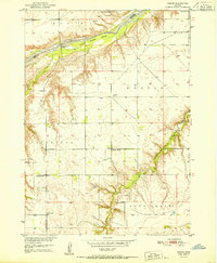
1951 Map of Dustin
USGS Topo · Published 1951About this map
The Niobrara River carves through this northern Nebraska landscape, creating a distinct boundary between Boyd and Holt counties. This 1951 survey, conducted for the Missouri River Basin development program, reveals a rural economy centered on the river and localized school districts. Evidence of early twentieth-century community life is found at the small settlement of Dustin, while the western portion of the map is dominated by the Cleveland township.
Find a feature on this map
21 named features on this map. Tap any name to fly to it.
Don’t see what you’re looking for? This feature index may not catch every label — zoom into the map to look around manually.
Map Details
Editions of this 1951 Dustin Map
2 editions found
Other maps of this area

1951 · Butte NW
USGS Topo · 1:24,000

1951 · Naper
USGS Topo · 1:24,000

1951 · Butte SW
USGS Topo · 1:24,000

1951 · Dustin
USGS Topo · 1:24,000

1951 · Naper SW
USGS Topo · 1:24,000

1954 · Stuart NW
USGS Topo · 1:24,000

1954 · Atkinson NW
USGS Topo · 1:24,000

1954 · Stuart NE
USGS Topo · 1:24,000

1955 · O'Neill
USGS Topo · 1:250,000

1959 · O'Neill
USGS Topo · 1:250,000