
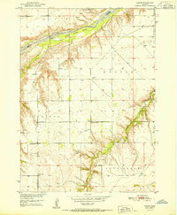
1951 Map of Dustin
USGS Topo · Published 1951About this map
The Niobrara River carves a path through the northern reach of this 1950s landscape, featuring a large river island and the crossing at Sand Rapids Bridge. This portion of Holt County and the southern edge of Boyd County reveal a traditional Great Plains settlement pattern of the early Cold War era, where local life centered on rural education and religious gatherings. The terrain is dotted with small schools like Brodie Sch and Highland Sch, reflecting the community structure before mid-century consolidation.
Find a feature on this map
22 named features on this map. Tap any name to fly to it.
Don’t see what you’re looking for? This feature index may not catch every label — zoom into the map to look around manually.
Map Details
Editions of this 1951 Dustin Map
2 editions found
Other maps of this area

1951 · Butte NW
USGS Topo · 1:24,000

1951 · Naper
USGS Topo · 1:24,000

1951 · Butte SW
USGS Topo · 1:24,000

1951 · Naper SW
USGS Topo · 1:24,000

1954 · Stuart NW
USGS Topo · 1:24,000

1954 · Atkinson NW
USGS Topo · 1:24,000

1954 · Stuart NE
USGS Topo · 1:24,000

1955 · O'Neill
USGS Topo · 1:250,000

1959 · O'Neill
USGS Topo · 1:250,000
1964 · Naper NW
USGS Topo · 1:24,000