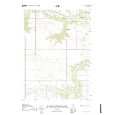
2017 Map of Dutch Creek
USGS Topo · Published 2017About this map
The Niobrara National Scenic River defines the northern boundary of this landscape where the borders of Keya Paha and Brown Counties meet. The terrain is marked by a complex system of drainages and seasonal watercourses, including the deeply incised Devils Gulch and the winding path of Plum Creek. Further south, the map reveals the recreational and hydraulic features of Keller Park Ponds, situated near the confluence of Bone Creek and Sand Draw.
Find a feature on this map
15 named features on this map. Tap any name to fly to it.
Don’t see what you’re looking for? This feature index may not catch every label — zoom into the map to look around manually.
Map Details
Editions of this 2017 Dutch Creek Map
This is the sole edition of this map. No revisions or reprints were ever made.
Other maps of this area

1949 · Dutch Creek
USGS Topo · 1:24,000

1950 · Bassett NW
USGS Topo · 1:24,000

1950 · Meadville
USGS Topo · 1:24,000

1950 · Huddle Table
USGS Topo · 1:24,000

1950 · Dutch Creek
USGS Topo · 1:24,000

1954 · Ainsworth NW
USGS Topo · 1:24,000

1954 · Ainsworth SW
USGS Topo · 1:24,000

1954 · Ainsworth
USGS Topo · 1:24,000

1954 · Long Pine
USGS Topo · 1:24,000

1955 · O'Neill
USGS Topo · 1:250,000