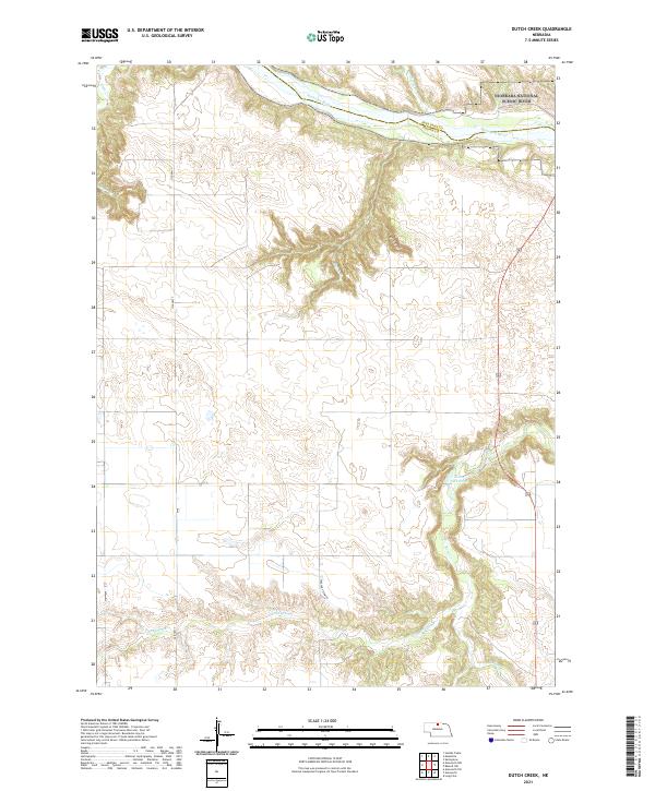
2021 Map of Dutch Creek
USGS Topo · Published 2021About this map
Niobrara River serves as the dominant hydrological feature of this Brown County landscape, cutting a deep valley through the Nebraska Sandhills. The terrain is defined by a network of drainage systems, including Plum Cr and Jewett Cr, which feed into the main river channel from the surrounding tablelands. This 2021 survey documents the contemporary boundaries of public and private lands along the river corridor, highlighting the significant elevation changes between the plateau surfaces and the canyon floor. The map illustrates the sparse infrastructure characteristic of the region, where roads primarily follow the section lines of the Public Land Survey System or navigate the more accessible ridge tops above the winding creek beds.
Find a feature on this map
3 named features on this map. Tap any name to fly to it.
Don’t see what you’re looking for? This feature index may not catch every label — zoom into the map to look around manually.
Map Details
Editions of this 2021 Dutch Creek Map
This is the sole edition of this map. No revisions or reprints were ever made.
Other maps of this area

1949 · Dutch Creek
USGS Topo · 1:24,000

1950 · Bassett NW
USGS Topo · 1:24,000

1950 · Meadville
USGS Topo · 1:24,000

1950 · Huddle Table
USGS Topo · 1:24,000

1950 · Dutch Creek
USGS Topo · 1:24,000

1954 · Ainsworth NW
USGS Topo · 1:24,000

1954 · Ainsworth SW
USGS Topo · 1:24,000

1954 · Ainsworth
USGS Topo · 1:24,000

1954 · Long Pine
USGS Topo · 1:24,000

1955 · O'Neill
USGS Topo · 1:250,000